
How to draw property boundaries on a map
Draw and adjust a property outline in MarkMyProperty: find the location, tap corners in order, undo points, review area and save a marked, sale or rental record.
By MarkMyProperty · Updated
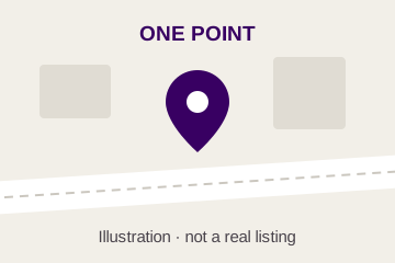
Decide whether a point or outline explains the property
Use Drop a pin when one point is enough to locate the offered place. Use Draw the boundary when the shape helps explain a plot, agricultural holding or building footprint. A pin does not describe the area around it, and an outline should not silently include adjoining land.
Decide which space the record concerns before drawing. A building footprint, a whole land parcel and a unit inside a building are different things. Describe that distinction in the listing. For an apartment, a pin can locate the building; it does not identify a particular floor or unit on its own.
Find the location before adding corners
Open Mark Property for Free and sign in. In the Location screen, choose Draw the boundary. Enter an address, area or landmark in Search address, area or landmark, then select Find. In drawing mode, Find and Use my location move the view only; they do not replace the selected property address or trace a parcel. The first corner of your drawing supplies the address suggestion.
Zoom until you can distinguish the area you intend to show. The map starts with satellite imagery; Map view switches to a road map, and Satellite view switches back. Use both to understand the approach. Use my location is optional and can require browser permission; you can search instead if location access is blocked or you are not at the property. Review the suggested address, and correct it if needed.
Tap distinct corners around the perimeter
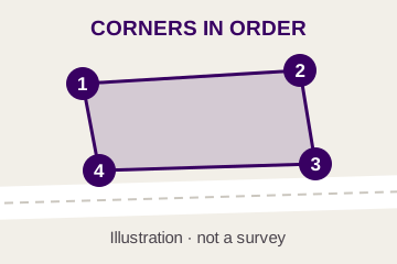
Tap the first corner, then continue around the perimeter in one direction. At least three distinct points are needed for a closed shape. The map joins the points for you; do not add the first point again merely to close it. Add another corner where the outline changes direction rather than drawing a line through an unrelated parcel.
The numbered illustration shows a simple four-corner shape. A real parcel may need a different number of corners, and its visible features may not match the legal extent. Zoom and check the whole outline before selecting Next. Do not use satellite imagery alone to resolve a disputed boundary.
- Draw only the space your record describes.
- Follow the perimeter in order instead of jumping across the parcel.
- Use distinct points and check for crossed edges.
- Check the entrance and written location separately from the outline.
Correct points and understand validation messages
Drag a corner or an editable midpoint handle to adjust the outline. Undo point removes the last point; Clear removes the drawing so you can start again. If you picked the wrong location, search the correct place and redraw the outline there.
The website will ask for at least three points, reject an outline that crosses itself and flag a shape with no area or an unusually large area. Correct the corners instead of entering invented measurements to work around the message. A valid shape means it passes these software checks, not that its legal boundary has been verified.
Review calculated area before using it in a listing
With a valid outline, the map displays calculated area in square metres, square feet and acres. This value comes from your chosen corner coordinates. Moving a corner changes the result; zoom level, image interpretation and the chosen extent can affect what you enter.
When you continue from a drawing and the area field is empty, the website prefills an area in your selected unit. Review that field in Details. If you use another supported measurement, enter it with its unit and explain its source. RICS distinguishes land ownership area, a planning site area and net development area; one figure does not necessarily describe all three.
- State whether the area is land, built space or usable interior space.
- Identify whether the figure is drawn, estimated or supported by another measurement.
- Keep the number, unit, description and offered extent consistent.
- Do not describe a calculated drawing area as a surveyed measurement.
Choose purpose, visibility and the required details
In Type, select Just mark it for a location record, Sell it for a sale offer or Rent it out for a rental offer. Purpose is separate from visibility. In Details, all three purposes require a positive price or value, currency, area and unit. The rental form asks for monthly rent. Add a title and description that explain what the drawing represents.
Proceed through Photos and Contact, then review Check and publish. Sale and rental offers require a valid private phone number or email. Choose public visibility for discovery or private visibility for an owner record. Keep contact and personal documents out of public text and photographs. A marked record is not automatically a sale or rental advertisement.
Use the map for orientation and separate formal evidence
After saving, open the property page and compare its outline, place name, area and description. Return to My Properties to edit the existing record if the offer or information changes. A map pin, user outline or contact reveal does not establish ownership, permitted use, access rights or current availability.
Formal boundary evidence and procedures depend on the jurisdiction. As one country-specific example, GOV.UK explains that most title plans in England and Wales show general rather than exact boundaries. That guidance does not define the rules elsewhere. Use the relevant local records and qualified professionals for formal boundary questions.
Sources and further reading
Frequently asked questions
How can I draw my property boundary on a map?
Open Mark Property for Free, sign in and choose Draw the boundary in Location. Find the place, tap at least three distinct corners around its perimeter, adjust the outline and review its area before continuing through the listing steps.
Why does searching an address not draw the boundary?
In drawing mode, Find moves the map to the searched location without changing the selected property address or outline. Tap the parcel corners yourself; the first corner supplies an address suggestion. The website does not fetch an official cadastral boundary from the address.
How do I fix an outline that crosses itself?
Check the order of the corners and move them around the perimeter. Use Undo point for the last point, drag a corner to correct it, or Clear to start the drawing again.
Does the area calculated from my drawing replace a survey?
No. It is calculated from the coordinates you entered for orientation. State its measurement basis and use appropriate local records or a qualified surveyor when formal boundaries or measurements matter.
Can I keep my property map private?
Yes. Public or private visibility is chosen separately from marked, sale or rental purpose. Private visibility keeps the record in the owner workflow rather than public discovery.